
Eircode Address File (ECAF)
Base reference dataset containing over 2.4 million address points with their Eircode and postal address information.
Identify and validate all 2.4 million Irish addresses, in the same data model as 246 other countries.






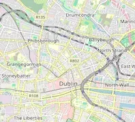

D01 NY06
Dublin
 Standardized data modelEircode datasets integrated into our data schema, with the same fields and hierarchy as the other 246 countries we cover.
 Fast and easy licensingA dedicated contact within 24 hours, from the first call to delivered data, with all Eircode paperwork handled for you.
 Single procurementOne vendor for Ireland and 246 other countries and territories, instead of a per-country vendor stack.
| ISO | Country | Language | Region 1 | Region 2 | Region 3 | Region 4 | Locality | Eircode | Latitude | Longitude | Timezone |
|---|---|---|---|---|---|---|---|---|---|---|---|
| IE | Ireland | EN | Connacht | Galway City | Menlough | N/A | Angliham | H91 E6CK | 53.31419 | -9.052939 | Europe/Dublin |
| IE | Ireland | EN | Connacht | Galway City | Menlough | N/A | Angliham | H91 FHH0 | 53.313843 | -9.0522 | Europe/Dublin |
| IE | Ireland | EN | Connacht | Galway City | Menlough | N/A | Angliham | H91 NNY0 | 53.314634 | -9.053057 | Europe/Dublin |
| IE | Ireland | EN | Connacht | Galway City | Menlough | N/A | Ballinfoyle | H91 A895 | 53.304176 | -9.033888 | Europe/Dublin |
| IE | Ireland | EN | Connacht | Galway City | Menlough | N/A | Ballinfoyle | H91 C58F | 53.297597 | -9.036365 | Europe/Dublin |
| IE | Ireland | EN | Connacht | Galway City | Menlough | N/A | Ballinfoyle | H91 HD74 | 53.297859 | -9.036341 | Europe/Dublin |
| IE | Ireland | EN | Connacht | Galway City | Menlough | N/A | Ballinfoyle | H91 WC99 | 53.300722 | -9.035644 | Europe/Dublin |
| IE | Ireland | EN | Connacht | Galway City | Menlough | N/A | Carrowbrowne | H91 K1WH | 53.313473 | -9.028123 | Europe/Dublin |
| IE | Ireland | EN | Connacht | Galway City | Menlough | N/A | Galway | H91 030C | 53.294965 | -9.037599 | Europe/Dublin |
| IE | Ireland | EN | Connacht | Galway City | Menlough | N/A | Galway | H91 04Y0 | 53.29506 | -9.036923 | Europe/Dublin |
| IE | Ireland | EN | Connacht | Galway City | Menlough | N/A | Galway | H91 05P6 | 53.287258 | -9.049393 | Europe/Dublin |
| IE | Ireland | EN | Connacht | Galway City | Menlough | N/A | Galway | H91 079F | 53.294845 | -9.037187 | Europe/Dublin |
| IE | Ireland | EN | Connacht | Galway City | Menlough | N/A | Galway | H91 0E40 | 53.294882 | -9.037293 | Europe/Dublin |
| IE | Ireland | EN | Connacht | Galway City | Menlough | N/A | Galway | H91 125H | 53.294906 | -9.037392 | Europe/Dublin |
| IE | Ireland | EN | Connacht | Galway City | Menlough | N/A | Galway | H91 12H9 | 53.294895 | -9.037337 | Europe/Dublin |
| IE | Ireland | EN | Connacht | Galway City | Menlough | N/A | Galway | H91 162X | 53.29497 | -9.036752 | Europe/Dublin |
| IE | Ireland | EN | Connacht | Galway City | Menlough | N/A | Galway | H91 1E86 | 53.295108 | -9.037013 | Europe/Dublin |
| IE | Ireland | EN | Connacht | Galway City | Menlough | N/A | Galway | H91 259Y | 53.294906 | -9.037392 | Europe/Dublin |
| IE | Ireland | EN | Connacht | Galway City | Menlough | N/A | Galway | H91 31W7 | 53.294864 | -9.037229 | Europe/Dublin |
| IE | Ireland | EN | Connacht | Galway City | Menlough | N/A | Galway | H91 382T | 53.294846 | -9.037187 | Europe/Dublin |
| IE | Ireland | EN | Connacht | Galway City | Menlough | N/A | Galway | H91 39N6 | 53.294965 | -9.037599 | Europe/Dublin |
| IE | Ireland | EN | Connacht | Galway City | Menlough | N/A | Galway | H91 3V70 | 53.294821 | -9.037133 | Europe/Dublin |
| IE | Ireland | EN | Connacht | Galway City | Menlough | N/A | Galway | H91 430E | 53.295145 | -9.037099 | Europe/Dublin |
| IE | Ireland | EN | Connacht | Galway City | Menlough | N/A | Galway | H91 452A | 53.295144 | -9.037099 | Europe/Dublin |
| IE | Ireland | EN | Connacht | Galway City | Menlough | N/A | Galway | H91 49F3 | 53.290959 | -9.0471 | Europe/Dublin |
| IE | Ireland | EN | Leinster | Dublin | Rotunda A | N/A | Dublin | D01 A243 | 53.358569 | -6.262132 | Europe/Dublin |
| IE | Ireland | EN | Leinster | Dublin | Rotunda A | N/A | Dublin | D01 AP23 | 53.355021 | -6.259016 | Europe/Dublin |
| IE | Ireland | EN | Leinster | Dublin | Rotunda A | N/A | Dublin | D01 CH93 | 53.355249 | -6.259847 | Europe/Dublin |
| IE | Ireland | EN | Leinster | Dublin | Rotunda A | N/A | Dublin | D01 DV70 | 53.353346 | -6.256535 | Europe/Dublin |
| IE | Ireland | EN | Leinster | Dublin | Rotunda A | N/A | Dublin | D01 DX02 | 53.357399 | -6.260562 | Europe/Dublin |
| IE | Ireland | EN | Leinster | Dublin | Rotunda A | N/A | Dublin | D01 E0C2 | 53.353735 | -6.259264 | Europe/Dublin |
| IE | Ireland | EN | Leinster | Dublin | Rotunda A | N/A | Dublin | D01 E422 | 53.353184 | -6.2575 | Europe/Dublin |
| IE | Ireland | EN | Leinster | Dublin | Rotunda A | N/A | Dublin | D01 F576 | 53.355342 | -6.259298 | Europe/Dublin |
| IE | Ireland | EN | Leinster | Dublin | Rotunda A | N/A | Dublin | D01 F8F1 | 53.3529 | -6.261302 | Europe/Dublin |
| IE | Ireland | EN | Leinster | Dublin | Rotunda A | N/A | Dublin | D01 FC62 | 53.356416 | -6.263351 | Europe/Dublin |
| IE | Ireland | EN | Leinster | Dublin | Rotunda A | N/A | Dublin | D01 HX46 | 53.35399 | -6.258349 | Europe/Dublin |
| IE | Ireland | EN | Leinster | Dublin | Rotunda A | N/A | Dublin | D01 K125 | 53.356526 | -6.259877 | Europe/Dublin |
| IE | Ireland | EN | Leinster | Dublin | Rotunda A | N/A | Dublin | D01 K3K0 | 53.354322 | -6.259168 | Europe/Dublin |
| IE | Ireland | EN | Leinster | Dublin | Rotunda A | N/A | Dublin | D01 KH51 | 53.355815 | -6.263359 | Europe/Dublin |
| IE | Ireland | EN | Leinster | Dublin | Rotunda A | N/A | Dublin | D01 NN97 | 53.353875 | -6.257745 | Europe/Dublin |
| IE | Ireland | EN | Leinster | Dublin | Rotunda A | N/A | Dublin | D01 NX56 | 53.357865 | -6.261176 | Europe/Dublin |
| IE | Ireland | EN | Leinster | Dublin | Rotunda A | N/A | Dublin | D01 NY06 | 53.356557 | -6.259788 | Europe/Dublin |
| IE | Ireland | EN | Leinster | Dublin | Rotunda A | N/A | Dublin | D01 PF63 | 53.357921 | -6.261886 | Europe/Dublin |
| IE | Ireland | EN | Leinster | Dublin | Rotunda A | N/A | Dublin | D01 PX24 | 53.356556 | -6.259788 | Europe/Dublin |
| IE | Ireland | EN | Leinster | Dublin | Rotunda A | N/A | Dublin | D01 RY70 | 53.354729 | -6.25982 | Europe/Dublin |
| IE | Ireland | EN | Leinster | Dublin | Rotunda A | N/A | Dublin | D01 T1K7 | 53.355072 | -6.257811 | Europe/Dublin |
| IE | Ireland | EN | Leinster | Dublin | Rotunda A | N/A | Dublin | D01 VR80 | 53.354018 | -6.25985 | Europe/Dublin |
| IE | Ireland | EN | Leinster | Dublin | Rotunda A | N/A | Dublin | D01 W407 | 53.353965 | -6.256968 | Europe/Dublin |
| IE | Ireland | EN | Leinster | Dublin | Rotunda A | N/A | Dublin | D01 X563 | 53.358636 | -6.261529 | Europe/Dublin |
| IE | Ireland | EN | Leinster | Dublin | Rotunda A | N/A | Dublin | D01 Y1E8 | 53.352711 | -6.260673 | Europe/Dublin |
| IE | Ireland | EN | Munster | Cork City | City Hall A | N/A | Cork | T12 AV60 | 51.893383 | -8.462203 | Europe/Dublin |
| IE | Ireland | EN | Munster | Cork City | City Hall A | N/A | Cork | T12 C6D3 | 51.892532 | -8.463916 | Europe/Dublin |
| IE | Ireland | EN | Munster | Cork City | City Hall A | N/A | Cork | T12 C7KV | 51.894562 | -8.46348 | Europe/Dublin |
| IE | Ireland | EN | Munster | Cork City | City Hall A | N/A | Cork | T12 CD66 | 51.896212 | -8.462743 | Europe/Dublin |
| IE | Ireland | EN | Munster | Cork City | City Hall A | N/A | Cork | T12 CF78 | 51.896213 | -8.462743 | Europe/Dublin |
| IE | Ireland | EN | Munster | Cork City | City Hall A | N/A | Cork | T12 F5FV | 51.891733 | -8.466283 | Europe/Dublin |
| IE | Ireland | EN | Munster | Cork City | City Hall A | N/A | Cork | T12 F6T1 | 51.892281 | -8.464978 | Europe/Dublin |
| IE | Ireland | EN | Munster | Cork City | City Hall A | N/A | Cork | T12 FA47 | 51.896212 | -8.462743 | Europe/Dublin |
| IE | Ireland | EN | Munster | Cork City | City Hall A | N/A | Cork | T12 H012 | 51.895627 | -8.462763 | Europe/Dublin |
| IE | Ireland | EN | Munster | Cork City | City Hall A | N/A | Cork | T12 H6F5 | 51.892479 | -8.464236 | Europe/Dublin |
| IE | Ireland | EN | Munster | Cork City | City Hall A | N/A | Cork | T12 HX4V | 51.894517 | -8.463833 | Europe/Dublin |
| IE | Ireland | EN | Munster | Cork City | City Hall A | N/A | Cork | T12 KW18 | 51.896212 | -8.462743 | Europe/Dublin |
| IE | Ireland | EN | Munster | Cork City | City Hall A | N/A | Cork | T12 R702 | 51.891027 | -8.463706 | Europe/Dublin |
| IE | Ireland | EN | Munster | Cork City | City Hall A | N/A | Cork | T12 RRC8 | 51.892842 | -8.464598 | Europe/Dublin |
| IE | Ireland | EN | Munster | Cork City | City Hall A | N/A | Cork | T12 RTX2 | 51.892566 | -8.465712 | Europe/Dublin |
| IE | Ireland | EN | Munster | Cork City | City Hall A | N/A | Cork | T12 T2P5 | 51.892343 | -8.467152 | Europe/Dublin |
| IE | Ireland | EN | Munster | Cork City | City Hall A | N/A | Cork | T12 T997 | 51.897062 | -8.465793 | Europe/Dublin |
| IE | Ireland | EN | Munster | Cork City | City Hall A | N/A | Cork | T12 V327 | 51.896213 | -8.462743 | Europe/Dublin |
| IE | Ireland | EN | Munster | Cork City | City Hall A | N/A | Cork | T12 V4FA | 51.892844 | -8.464304 | Europe/Dublin |
| IE | Ireland | EN | Munster | Cork City | City Hall A | N/A | Cork | T12 W1A2 | 51.891617 | -8.466011 | Europe/Dublin |
| IE | Ireland | EN | Munster | Cork City | City Hall A | N/A | Cork | T12 XA6W | 51.891849 | -8.464983 | Europe/Dublin |
| IE | Ireland | EN | Munster | Cork City | City Hall A | N/A | Cork | T12 XK76 | 51.891027 | -8.463706 | Europe/Dublin |
| IE | Ireland | EN | Munster | Cork City | City Hall A | N/A | Cork | T12 Y272 | 51.896213 | -8.462743 | Europe/Dublin |
| IE | Ireland | EN | Munster | Cork City | City Hall A | N/A | Cork | T12 Y4E2 | 51.891137 | -8.464984 | Europe/Dublin |
| IE | Ireland | EN | Munster | Cork City | City Hall A | N/A | Cork | T12 YF51 | 51.894198 | -8.464988 | Europe/Dublin |
| IE | Ireland | EN | Munster | Limerick | Shannon B | N/A | Limerick | V94 1P48 | 52.662119 | -8.628239 | Europe/Dublin |
| IE | Ireland | EN | Munster | Limerick | Shannon B | N/A | Limerick | V94 2P60 | 52.661876 | -8.62564 | Europe/Dublin |
| IE | Ireland | EN | Munster | Limerick | Shannon B | N/A | Limerick | V94 7N20 | 52.660443 | -8.628731 | Europe/Dublin |
| IE | Ireland | EN | Munster | Limerick | Shannon B | N/A | Limerick | V94 9H24 | 52.660584 | -8.6284 | Europe/Dublin |
| IE | Ireland | EN | Munster | Limerick | Shannon B | N/A | Limerick | V94 A093 | 52.659345 | -8.627974 | Europe/Dublin |
| IE | Ireland | EN | Munster | Limerick | Shannon B | N/A | Limerick | V94 AE44 | 52.662372 | -8.62785 | Europe/Dublin |
| IE | Ireland | EN | Munster | Limerick | Shannon B | N/A | Limerick | V94 C7F6 | 52.661276 | -8.624902 | Europe/Dublin |
| IE | Ireland | EN | Munster | Limerick | Shannon B | N/A | Limerick | V94 DDH4 | 52.661275 | -8.62914 | Europe/Dublin |
| IE | Ireland | EN | Munster | Limerick | Shannon B | N/A | Limerick | V94 DX78 | 52.662221 | -8.627445 | Europe/Dublin |
| IE | Ireland | EN | Munster | Limerick | Shannon B | N/A | Limerick | V94 E827 | 52.661465 | -8.627478 | Europe/Dublin |
| IE | Ireland | EN | Munster | Limerick | Shannon B | N/A | Limerick | V94 FC2V | 52.662675 | -8.623358 | Europe/Dublin |
| IE | Ireland | EN | Munster | Limerick | Shannon B | N/A | Limerick | V94 H361 | 52.659899 | -8.629451 | Europe/Dublin |
| IE | Ireland | EN | Munster | Limerick | Shannon B | N/A | Limerick | V94 H562 | 52.662258 | -8.623063 | Europe/Dublin |
| IE | Ireland | EN | Munster | Limerick | Shannon B | N/A | Limerick | V94 HH77 | 52.661063 | -8.627491 | Europe/Dublin |
| IE | Ireland | EN | Munster | Limerick | Shannon B | N/A | Limerick | V94 NXH1 | 52.664327 | -8.625674 | Europe/Dublin |
| IE | Ireland | EN | Munster | Limerick | Shannon B | N/A | Limerick | V94 R227 | 52.660921 | -8.626268 | Europe/Dublin |
| IE | Ireland | EN | Munster | Limerick | Shannon B | N/A | Limerick | V94 TY8W | 52.661002 | -8.624395 | Europe/Dublin |
| IE | Ireland | EN | Munster | Limerick | Shannon B | N/A | Limerick | V94 V653 | 52.661117 | -8.626751 | Europe/Dublin |
| IE | Ireland | EN | Munster | Limerick | Shannon B | N/A | Limerick | V94 W3CC | 52.663016 | -8.627255 | Europe/Dublin |
| IE | Ireland | EN | Munster | Limerick | Shannon B | N/A | Limerick | V94 X5X2 | 52.661301 | -8.625112 | Europe/Dublin |
| IE | Ireland | EN | Munster | Limerick | Shannon B | N/A | Limerick | V94 XV88 | 52.661444 | -8.627592 | Europe/Dublin |
| IE | Ireland | EN | Munster | Limerick | Shannon B | N/A | Limerick | V94 XY17 | 52.659345 | -8.627974 | Europe/Dublin |
| IE | Ireland | EN | Munster | Limerick | Shannon B | N/A | Limerick | V94 Y2N2 | 52.661488 | -8.62704 | Europe/Dublin |
| IE | Ireland | EN | Munster | Limerick | Shannon B | N/A | Limerick | V94 Y5F6 | 52.663405 | -8.624277 | Europe/Dublin |
| IE | Ireland | EN | Munster | Limerick | Shannon B | N/A | Limerick | V94 YW59 | 52.662081 | -8.62402 | Europe/Dublin |
Eircode is Ireland’s national postal code system. It assigns a unique 7-character code to each of the 2.4 million residential and business addresses in the country, enabling accurate identification of every address. That includes the 800,000 non-unique addresses that share their address with at least one other property. Use Eircode data to validate addresses and resolve ambiguity across your systems.
We license both datasets and integrate them into our standardized data model.
Base reference dataset containing over 2.4 million address points with their Eircode and postal address information.
Integrates ECAF and adds latitude and longitude coordinates, alias addresses, building information, and boundary data.

Identify every Irish address with Eircode, including the 800,000 that would otherwise be identical to another address in Ireland.

Use unique Irish address points to optimize last-mile routes and delivery schedules.

Detect inconsistent or fake Irish addresses in KYC, AML, and risk checks.

Cut friction and abandonment at checkout and onboarding with Eircode-powered address autocomplete.

Reduce regulatory and reputational risk with a defensible, auditable identifier for every Irish address.

Reconcile, combine, and clean duplicate or inaccurate Irish addresses across your systems.
Flexible deployment, seamless integration and structured updates, all within your own infrastructure.
Select the delivery option that fits your infrastructure.
Download the full database directly from your Customer Portal.
Retrieve the full files via API for automated ingestion into your pipeline.
Access the data in your cloud environment: Snowflake, Azure Data Share or AWS.
Import the data easily into any software, database, ERP, CRM, MDM, GIS, BI and GIS system.












Frequent updates will keep your data always up-to-date.
Download full, updated datasets to refresh your system.
Retrieve only the new, updated and deleted records to ensure integrity and traceability.
Comprehensive field definitions and data specifications from GeoPostcodes Eircode database
| Field name | Description | Field type |
|---|---|---|
| ISO | ISO 3166-1 country code | Char(2) |
| Country | Country name | Char(50) |
| Language | Language code | Char(2) |
| ID | Record identifier | Integer |
| Region 1 | Administrative division level 1 | Char(80) |
| Region 2 | Administrative division level 2 | Char(80) |
| Region 3 | Administrative division level 3 | Char(80) |
| Region 4 | Administrative division level 4 | Char(80) |
| Locality | Locality name | Char(80) |
| Postcode | ZIP / Postal code | Char(15) |
| Suburb | Locality subdivision | Char(80) |
| Latitude | Place latitude (WGS84 coordinates) | Double |
| Longitude | Place longitude (WGS84 coordinates) | Double |
| Elevation | Elevation in meters | Integer |
| ISO2 | ISO 3166-2 region code | Char(10) |
| FIPS | The Federal Information Processing Standard, publication 10-4 (FIPS 10-4) | Char(10) |
| NUTS | European statistical division code | Char(12) |
| HASC | Hierarchical administrative subdivision code | Char(12) |
| STAT | National statistics/census code | Char(20) |
| Timezone | Time zone name (Olson) | Char(30) |
| UTC | Standard time expressed as an offset with respect to UTC | Char(10) |
| DST | Daylight saving time expressed as an offset with respect to UTC | Char(10) |
| locality_type | Type of place, ‘town’ or ‘business’ | Char(20) |
| is_postal | Whether the postal code is used for regular mail | Integer |
| is_business | Whether the postal code is used for businesses | Integer |
| is_po_box | Whether the postal code is used for PO Boxes | Integer |
| post_town | Postal Town (e.g. USPS recommended city) | Char(80) |
Complete coverage across 247 countries, including hard-to-source geographies like China, Japan, Brazil, and Russia.
Built on extensive, authoritative sourcing with robust data engineering and quality control. Standardized and up-to-date.
With 15 years of experience, we guide your implementation and deliver data in the format that fits your system.
Join more than 100 enterprise clients who trust GeoPostcodes for their location data

“GeoPostcodes' global ZIP codes allow us to determine distances accurately. Thanks to their up-to-date database, we no longer have problems with missing locations, making our system much more efficient and reliable.”


“The concept of the city receives different names or belongs to different hierarchical levels depending on the country. Using GeoPostcodes' data gave us access to city definitions aligned with our customers' expectations, saving us computation time.”


“GeoPostcodes' multi-level boundaries were perfectly aligned, enabling seamless integration with multiple secure cloud platforms. Our software can now provide more accurate visualizations for risk analysis and natural hazard monitoring.”


“GeoPostcodes databases provide IATA codes, enhanced UNLOCODEs with port terminal data, addresses, and more – all on a global scale! This level of accuracy is essential for our mileage and CO2 emissions calculation.”


“The world is constantly changing. New localities and neighborhoods open up or become dispersed. It's good to know that GeoPostcodes is keeping on top of those changes and providing us with updated information to work with.”


“Countries like Brazil or China are particularly strict with their customs validation. GeoPostcodes' ZIP codes and Enhanced UNLOCODES database are aligned with national regulations, ensuring seamless transportation and compliance.”

“GeoPostcodes' Population data shows population forecasts over the next years. We can use it as a proxy to justify longer-term changes and downgrade postal code areas in terms of economic viability.”


“The key aspect of working with GeoPostcodes has been their ability to provide customized data solutions. Their collaborative approach has made them an excellent partner in addressing our location data challenges.”


“If you've got a business where locations are a big part of it and you're looking to avoid the large costs that can be involved in using APIs, GeoPostcodes' on-premise database is definitely worth considering.”

Eircodes are Ireland’s postal codes. Each Eircode is a seven-character alphanumeric code that uniquely identifies a single residential or business address, with 2.2 million codes covering every address in the country. Introduced in 2015, they were the first public system of unique identifiers for all Irish addresses.
Each Eircode has two parts: a three-character routing key indicating a broad geographic area, and a four-character unique identifier assigned to a specific building or address. For example, D01 NY06 identifies a single property in Dublin.
A non-unique address is a property that shares the same address with at least one other property in the area. These addresses have no unique house name or number to identify their correct location.
In Ireland, over 35% of addresses are non-unique, roughly 800,000 properties. Several properties can share the same address, which makes it difficult for businesses delivering goods or services to reach the right location.
Eircode solves this by assigning a unique 7-character code to every address in Ireland, so each property can be identified on its own.
The Eircode Database is updated regularly to reflect Ireland’s postal and administrative changes. You can choose when you update the data in your system:
Common use cases for the Eircode Database include:
Eircodes bring precision to Irish addressing, with practical benefits across operations:
Yes. GeoPostcodes datasets are provided in text files (the most popular format is CSV), so you can easily import the Eircode Database into any software, database, ERP, CRM, MDM, GIS, or BI system.
Customers commonly integrate it with Power BI, Tableau, Carto, Microsoft Dynamics 365, Salesforce, SAP, Oracle, Sage, Esri, QGIS, and Informatica.
The Eircode Database is delivered in the following formats: CSV, ASC, GeoJSON, and Shapefile. The most popular format is CSV.
GeoPostcodes delivers its data in text files (the most popular format is CSV) that you can easily integrate into your databases and processes. Hosting your own data gives you full control over security, compliance, and performance at a fixed cost, regardless of volume.
Choose the delivery method that fits your infrastructure best:
The Eircode Database is updated regularly to reflect Ireland’s postal and administrative changes. You can choose when you update the data in your system:
The Eircode Database covers all 2.4 million Irish addresses. Each record carries its unique 7-character Eircode, street name, house numbers, locality, and administrative divisions up to 4 levels deep.
Records also include latitude and longitude coordinates, statistical codes (ISO, FIPS, NUTS, HASC, and STAT), time zone, and post town. Address names are available in both English and Irish.
For the full list of fields, see the data dictionary.
Contact us to discuss your project and we will schedule a call to understand your use case, answer any questions, and share sample data for evaluation. Once the agreement is signed, we will activate your dataset and introduce you to your Customer Success Manager, who will guide you through onboarding and help you integrate the data.
GeoPostcodes’ annual licenses are priced per product, country coverage, and use case. Our licenses include access to your data, ongoing updates, and support from a dedicated expert who guides the integration and answers your team’s questions.
Share your needs with our team, and we will prepare a proposal tailored to your project.